File:1852 Bocage Map of Australia and Polynesia - Geographicus - Oceanie-bocage-1852.jpg
From WikiMD's medical encyclopedia

Size of this preview: 800 × 589 pixels. Other resolutions: 320 × 236 pixels | 640 × 471 pixels | 1,024 × 754 pixels | 1,280 × 943 pixels | 2,560 × 1,886 pixels | 3,000 × 2,210 pixels.
Original file (3,000 × 2,210 pixels, file size: 2.19 MB, MIME type: image/jpeg)
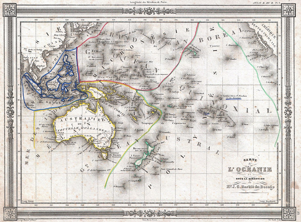
| Carte de l'Océanie dressée et dessinée sous la direction de Mr. J. G. Barbié du Bocage. | |||
|---|---|---|---|
| Artist | |||
| Title |
Carte de l'Océanie dressée et dessinée sous la direction de Mr. J. G. Barbié du Bocage. |
||
| Description |
English: An uncommon and extremely attractive 1852 map of Oceania by J. G. Barbié du Bocage. Includes Australia, New Zealand, Polynesia, Micronesia, Melanesia and Malaysia. Australia is described as “pays inconnu” and alternately labeled “New Holland”. Hawaii shown as the “Sandwich Islands”. Features a beautiful frame style border. Prepared by J. G. Barbié du Bocage for publication as plate no. 25 in Maison Basset’s 1852 edition of the Atlas illustré . |
||
| Date | 1852 (undated) | ||
| Dimensions | height: 9 in (22.8 cm); width: 12.5 in (31.7 cm) | ||
| Accession number |
Geographicus link: Oceanie-bocage-1852 |
||
| Source/Photographer |
Maison Basset, Atlas Illustré, (1852 issue).
|
||
Licensing
|
This is a faithful photographic reproduction of a two-dimensional, public domain work of art. The work of art itself is in the public domain for the following reason:
The official position taken by the Wikimedia Foundation is that "faithful reproductions of two-dimensional public domain works of art are public domain".
This photographic reproduction is therefore also considered to be in the public domain in the United States. In other jurisdictions, re-use of this content may be restricted; see Reuse of PD-Art photographs for details. | ||||
File history
Click on a date/time to view the file as it appeared at that time.
| Date/Time | Thumbnail | Dimensions | User | Comment | |
|---|---|---|---|---|---|
| current | 19:13, 22 March 2011 | | 3,000 × 2,210 (2.19 MB) | BotMultichillT | {{subst:User:Multichill/Geographicus |link=http://www.geographicus.com/P/AntiqueMap/Oceanie-bocage-1852 |product_name=1852 Bocage Map of Australia and Polynesia |map_title=Carte de L'Oceanie dressee ET dessinee sous laDirection de Mr. J. G. Barbie du Boca |
File usage
The following page uses this file: