File:Boston, 1775bsmall1.png
From WikiMD's WELLNESSPEDIA
Size of this preview: 425 × 600 pixels. Other resolutions: 170 × 240 pixels | 340 × 480 pixels | 544 × 768 pixels | 725 × 1,024 pixels | 2,480 × 3,500 pixels.
Original file (2,480 × 3,500 pixels, file size: 15.87 MB, MIME type: image/png)
|
| This is a retouched picture, which means that it has been digitally altered from its original version. Modifications: dirt and stains removed, levels and color adjusted; slightly cropped and rotated. The original can be viewed here: Boston, 1775small1.png:
|
Summary
| Description |
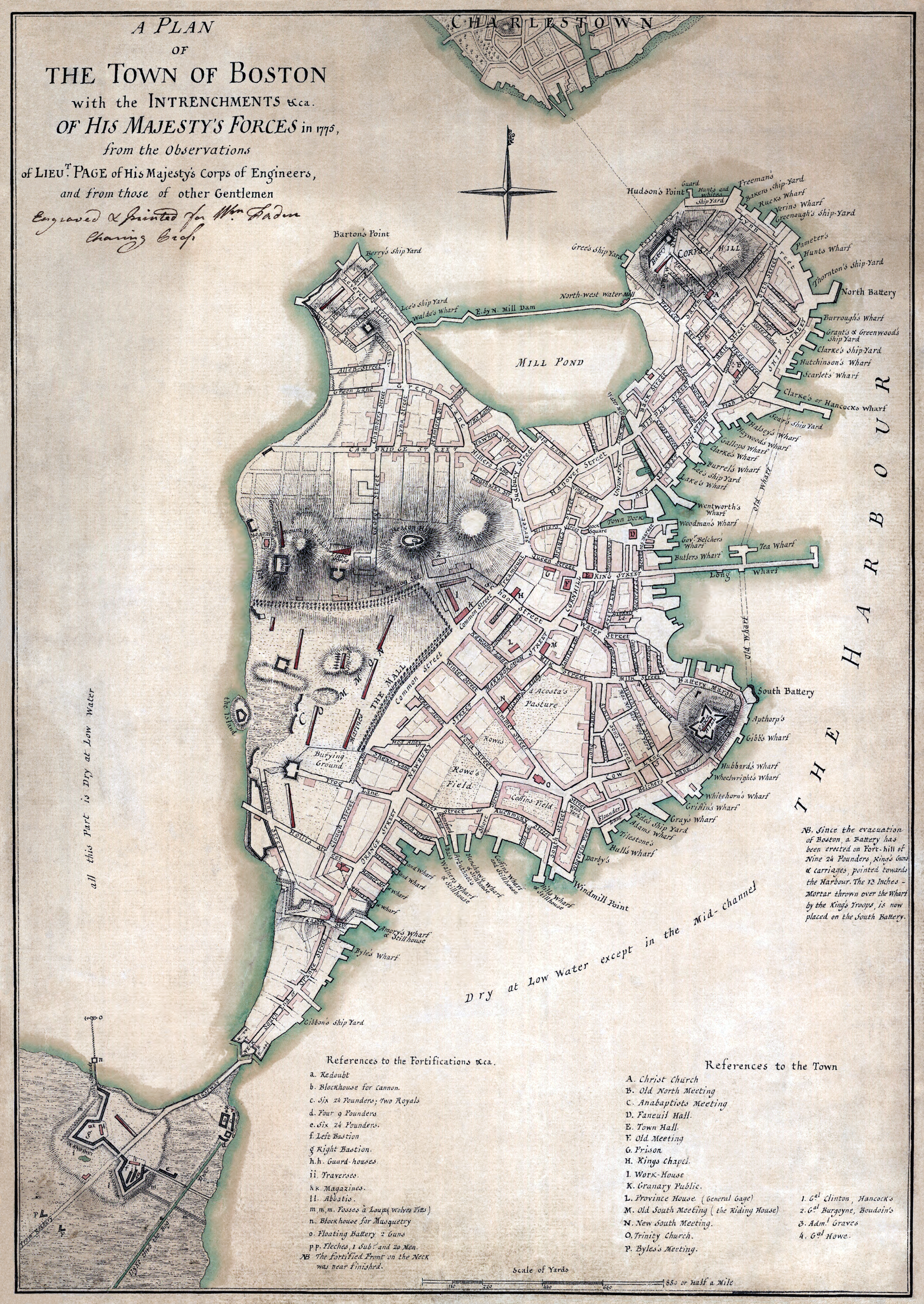
English: A plan of the town of Boston with the intrenchments &ca. of His Majesty's forces in 1775, from the observations of Lieut. Page of His Majesty's Corps of Engineers, and from those of other gentlemen."
العربية: خريطة تظهر تقييم ميداني بريطاني لبوسطن في عام 1775. |
||||||||||||||||||||
| Date | |||||||||||||||||||||
| Source |
|
||||||||||||||||||||
| Author |
|
||||||||||||||||||||
_by_James_Northcote.jpeg)
Licensing
This work is in the public domain in the United States because it was published (or registered with the U.S. Copyright Office) before January 1, 1931.
|
| This work is from the Library of Congress. According to the library, there are no known copyright restrictions on the use of this work. |  |
File history
Click on a date/time to view the file as it appeared at that time.
| Date/Time | Thumbnail | Dimensions | User | Comment | |
|---|---|---|---|---|---|
| current | 00:01, 17 July 2008 | | 2,480 × 3,500 (15.87 MB) | wikimediacommons>Durova | {{Information |Description="A plan of the town of Boston with the intrenchments &ca. of His Majesty's forces in 1775, from the observations of Lieut. Page of His Majesty's Corps of Engineers, and from those of other gentlemen." |Source=Library of Congress |
File usage
The following page uses this file:
