File:Census Regions and Division of the United States.svg

From WikiMD's medical encyclopedia
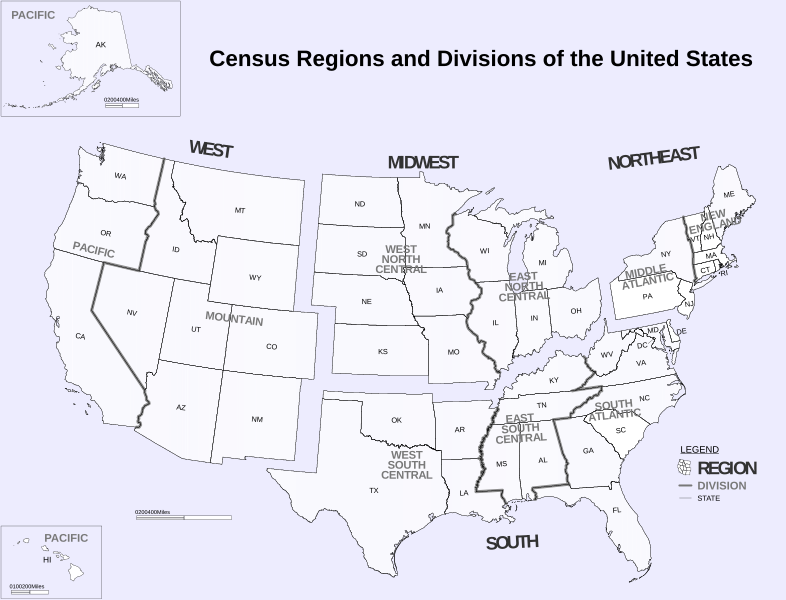
Original file(SVG file, nominally 942 × 719 pixels, file size: 1.27 MB)

This file is from Wikimedia Commons and may be used by other projects. The description on its file description page there is shown below.

Summary

Description
English: Census Regions and Division of the United States.
Date (from pdf)
Source https://www2.census.gov/geo/pdfs/maps-data/maps/reference/us_regdiv.pdf
Author US Census Bureau
Other versions File:Census Regions and Divisions.PNG
SVG development
InfoField
 The SVG code is valid.
 This map was created with Inkscape.
  This map uses embedded text that can be easily translated using a text editor.

Licensing

Public domain
This image or file is a work of a United States Census Bureau employee, taken or made as part of that person's official duties. As a work of the U.S. federal government, the image is in the public domain.

English  español  日本語  македонски  മലയാളം  português do Brasil  русский  suomi  українська  עברית  +/−

Captions

Map showing the Census Regions and Division of the United States.

Items portrayed in this file

depicts

7 September 2000

image/svg+xml

a47ca6a584b0499d82a2234dd99483333031aefa

1,335,895 byte

719 pixel

942 pixel

File history

Click on a date/time to view the file as it appeared at that time.

Date/TimeThumbnailDimensionsUserComment
current06:02, 6 November 2018Thumbnail for version as of 06:02, 6 November 2018942 × 719 (1.27 MB)JoKalliauerphab:35245 multiple xkoordinates

Metadata