File:Flag-map of the world.svg
From WikiMD's WELLNESSPEDIA

Size of this PNG preview of this SVG file: 800 × 400 pixels. Other resolution: 2,560 × 1,280 pixels.
Original file (SVG file, nominally 2,400 × 1,200 pixels, file size: 4.53 MB)
Summary[edit]
| Summary | |
|---|---|
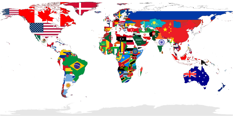
| Description | A map showing the flags of the world, in equirectangular projection. The countries shown are the members of the United Nations. Western Sahara is in light grey because it is considered to be a Non-Self-Governing Territory with no administration (source), therefore there is no UN member state flag to represent that place.
|
| Source | Wikimedia Commons file page |
| Author | JoKalliauer |
| Permission | See original Commons license details. |
Licensing[edit]
Public Domain
This file is in the public domain and may be used without restriction.
Please see the linked source page for the original file history, attribution information, and licensing details.
Original attribution and file history: Wikimedia Commons
File history
Click on a date/time to view the file as it appeared at that time.
| Date/Time | Thumbnail | Dimensions | User | Comment | |
|---|---|---|---|---|---|
| current | 13:40, 8 June 2026 | | 2,400 × 1,200 (4.53 MB) | Maintenance script (talk | contribs) | == Summary == Importing file |
You cannot overwrite this file.
File usage
The following page uses this file:
