File:GWI DU map.svg
From WikiMD's WELLNESSPEDIA

Size of this PNG preview of this SVG file: 558 × 599 pixels. Other resolution: 1,907 × 2,048 pixels.
Original file (SVG file, nominally 596 × 640 pixels, file size: 407 KB)
Summary[edit]
| Summary | |
|---|---|
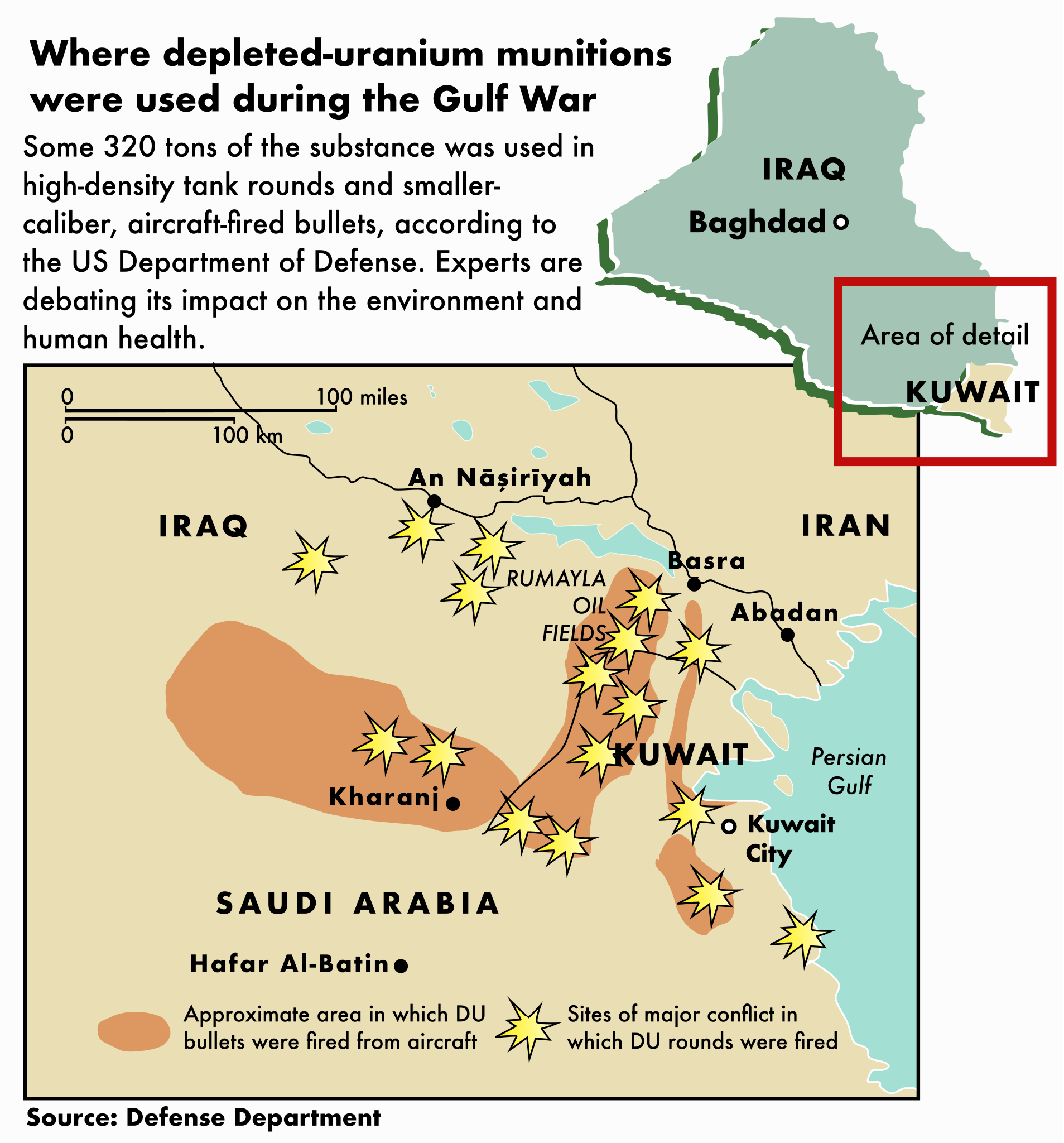
| Description | A map depicting where depleted uranium was fired, according to the DoD. |
| Source | Wikimedia Commons file page |
| Author | Office of the Special Assistant for Gulf War Illnesses; vectorization by Frank Geerlings |
| Permission | See original Commons license details. |
Licensing[edit]
Public Domain
This file is in the public domain and may be used without restriction.
Please see the linked source page for the original file history, attribution information, and licensing details.
Original attribution and file history: Wikimedia Commons
File history
Click on a date/time to view the file as it appeared at that time.
| Date/Time | Thumbnail | Dimensions | User | Comment | |
|---|---|---|---|---|---|
| current | 12:49, 29 May 2026 | | 596 × 640 (407 KB) | Maintenance script (talk | contribs) | == Summary == Importing file |
You cannot overwrite this file.
File usage
The following 2 pages use this file:
