File:Malacca Sultanate en.svg
From WikiMD's WELLNESSPEDIA

Size of this PNG preview of this SVG file: 512 × 581 pixels. Other resolution: 1,805 × 2,048 pixels.
Original file (SVG file, nominally 512 × 581 pixels, file size: 373 KB)
Summary[edit]
| Summary | |
|---|---|
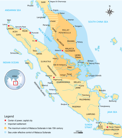
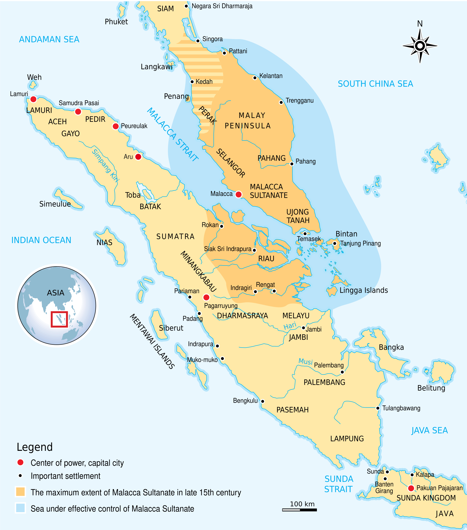
| Description | The historical map of Malacca Sultanate (1402–1511) Malay Peninsula and East Coast of Sumatra. Made and improved based on "Atlas Sejarah Indonesia dan Dunia" (The Atlas of Indonesian and World History), PT Pembina Peraga Jakarta 1996. |
| Source | Wikimedia Commons file page |
| Author | Gunawan Kartapranata |
| Permission | See original Commons license details. |
Licensing[edit]
Creative Commons Attribution-ShareAlike 3.0 Unported (CC BY-SA 3.0)
This file is licensed under the Creative Commons Attribution-ShareAlike 3.0 license.
Official license: CC BY-SA 3.0
License page: CC BY-SA 3.0
Original attribution and file history: Wikimedia Commons
File history
Click on a date/time to view the file as it appeared at that time.
| Date/Time | Thumbnail | Dimensions | User | Comment | |
|---|---|---|---|---|---|
| current | 22:33, 8 June 2026 | | 512 × 581 (373 KB) | Maintenance script (talk | contribs) | == Summary == Importing file |
You cannot overwrite this file.
File usage
The following page uses this file:
