File:Mongols-map.png
From WikiMD's WELLNESSPEDIA
Size of this preview: 722 × 599 pixels. Other resolution: 1,801 × 1,495 pixels.
Original file (1,801 × 1,495 pixels, file size: 2.79 MB, MIME type: image/png)
Summary[edit]
| Summary | |
|---|---|
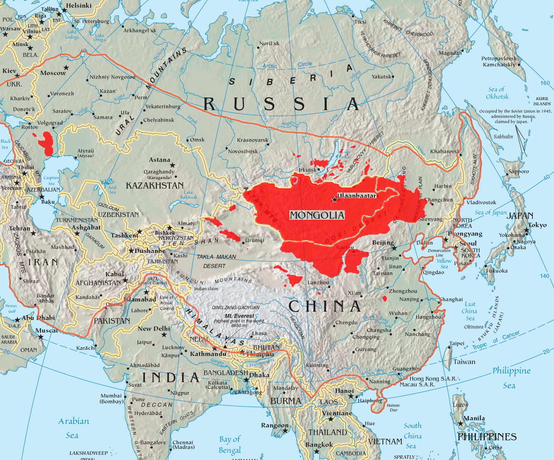
| Description | A map of the places that Mongol peoples live. The orange line shows the extent of the Mongol Empire in the late 13th century. The red areas are the places dominated by ethnic Mongols. |
| Source | Wikimedia Commons file page |
| Author | Quadell |
| Permission | See original Commons license details. |
Licensing[edit]
Creative Commons Attribution-ShareAlike 3.0 Unported (CC BY-SA 3.0)
This file is licensed under the Creative Commons Attribution-ShareAlike 3.0 license.
Official license: CC BY-SA 3.0
License page: CC BY-SA 3.0
Original attribution and file history: Wikimedia Commons
File history
Click on a date/time to view the file as it appeared at that time.
| Date/Time | Thumbnail | Dimensions | User | Comment | |
|---|---|---|---|---|---|
| current | 22:34, 8 June 2026 | | 1,801 × 1,495 (2.79 MB) | Maintenance script (talk | contribs) | == Summary == Importing file |
You cannot overwrite this file.
File usage
The following file is a duplicate of this file (more details):
- File:Mongols-map.png from Wikimedia Commons
The following page uses this file:
