File:Stonehenge plan.jpg
Original file (1,220 × 1,188 pixels, file size: 181 KB, MIME type: image/jpeg)
Summary[edit]
| Summary | |
|---|---|
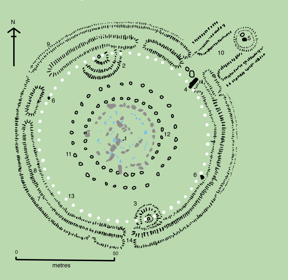
| Description | The site as of AD 2004. The plan omits the trilithon lintels for clarity. Holes that no longer, or never, contained stones are shown as open circles and stones visible today are shown coloured, grey for sarsen and blue for the imported stone, mainly bluestone.
Key to plan: 1 = The Altar Stone, a six ton monolith of green micaceous sandstone from Scotland 2 = barrow without a burial 3 = "Barrows" (without burials) 4 = The fallen Slaughter Stone, 4.9 metres long 5 = The Heel Stone 6 = Two of originally four Station Stones 7 = Ditch 8 = Inner bank 9 = Outer bank 10 = The Avenue, a parallel pair of ditches and banks leading 3 km to the River Avon 11 = Ring of 30 pits called the Y Holes 12 = Ring of 29 pits called the Z Holes 13 = Circle of 56 pits, known as the Aubrey holes 14 = Smaller southern entrance |
| Source | Wikimedia Commons file page |
| Author | Drawn by Adamsan |
| Permission | See original Commons license details. |
Licensing[edit]
Creative Commons Attribution-ShareAlike 3.0 Unported (CC BY-SA 3.0)
This file is licensed under the Creative Commons Attribution-ShareAlike 3.0 license.
Official license: CC BY-SA 3.0
License page: CC BY-SA 3.0
Original attribution and file history: Wikimedia Commons
File history
Click on a date/time to view the file as it appeared at that time.
| Date/Time | Thumbnail | Dimensions | User | Comment | |
|---|---|---|---|---|---|
| current | 22:35, 8 June 2026 | | 1,220 × 1,188 (181 KB) | Maintenance script (talk | contribs) | == Summary == Importing file |
You cannot overwrite this file.
File usage
The following page uses this file:
