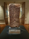
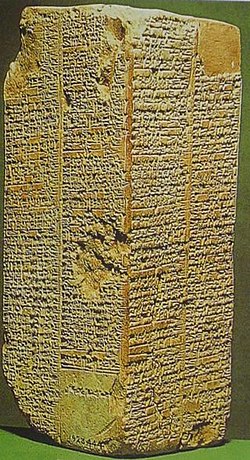
File:Sumerian King List, 1800 BC, Larsa, Iraq.jpg
From WikiMD's medical encyclopedia

Size of this preview: 450 × 600 pixels. Other resolutions: 180 × 240 pixels | 360 × 480 pixels | 576 × 768 pixels | 768 × 1,024 pixels | 1,536 × 2,048 pixels | 3,024 × 4,032 pixels.
Original file (3,024 × 4,032 pixels, file size: 2.69 MB, MIME type: image/jpeg)
This file is from Wikimedia Commons and may be used by other projects. The description on its file description page there is shown below.
Summary
Object
| Weld-Blundell Prism
|
|||||||||||||||||||||||||||
|---|---|---|---|---|---|---|---|---|---|---|---|---|---|---|---|---|---|---|---|---|---|---|---|---|---|---|---|
| Title |
Weld-Blundell Prism label QS:Lit,"Prisma di Weld-Blundell" label QS:Lja,"ウェルド ブランデル プリズム" label QS:Luk,"Призма Вельда-Бланделла" label QS:Lnl,"Weld-Blundell-prisma" label QS:Lca,"Prisma de Weld-Blundell" label QS:Lru,"Призма Вельда-Бланделла" label QS:Ltr,"Weld-Blundell Prizması" label QS:Len,"Weld-Blundell Prism" label QS:Lar,"منشور ويلد-بلونديل" label QS:Lsl,"Weld-Blundellova prizma" label QS:Les,"Prisma de Weld-Blundell" |
||||||||||||||||||||||||||
| Object type |
archaeological artefact / inscription |
||||||||||||||||||||||||||
| Description |
English: Cuneiform writing on a clay brick, written in the Sumerian language (during the time of the Akkadian empire), and listing all kings from the creation of kingship until 1800 BC when the list was created. |
||||||||||||||||||||||||||
| Language |
Sumerian |
||||||||||||||||||||||||||
| Date |
between 1827 and 1817 BC date QS:P,-1850-00-00T00:00:00Z/7,P1319,-1827-00-00T00:00:00Z/9,P1326,-1817-00-00T00:00:00Z/9 |
||||||||||||||||||||||||||
| Medium |
clay medium QS:P186,Q42302 |
||||||||||||||||||||||||||
| Dimensions |
height: 20 cm (7.8 in) dimensions QS:P2048,+20U174728 dimensions QS:P2049,+9U174728 |
||||||||||||||||||||||||||
| Collection |
institution QS:P195,Q636400 |
||||||||||||||||||||||||||
| Current location | |||||||||||||||||||||||||||
| Accession number |
AN1923.444 (Ashmolean Museum) |
||||||||||||||||||||||||||
| Object location |
|
||||||||||||||||||||||||||
| Place of creation |
Larsa |
||||||||||||||||||||||||||
| Place of discovery |
Larsa |
||||||||||||||||||||||||||
| Object history |
|
||||||||||||||||||||||||||
| References | |||||||||||||||||||||||||||
Photograph
| Date | |
| Source | Own work |
| Author | Gts-tg |
| Camera location | 51° 45′ 21″ N, 1° 15′ 37″ W | View this and other nearby images on: OpenStreetMap |
|---|
Licensing
I, the copyright holder of this work, hereby publish it under the following license:
This file is licensed under the Creative Commons Attribution-Share Alike 4.0 International license.
- You are free:
- to share – to copy, distribute and transmit the work
- to remix – to adapt the work
- Under the following conditions:
- attribution – You must give appropriate credit, provide a link to the license, and indicate if changes were made. You may do so in any reasonable manner, but not in any way that suggests the licensor endorses you or your use.
- share alike – If you remix, transform, or build upon the material, you must distribute your contributions under the same or compatible license as the original.
Captions
Add a one-line explanation of what this file represents
Items portrayed in this file
depicts
51°45'20.999"N, 1°15'37.001"W
2,817,545 byte
4,032 pixel
3,024 pixel
image/jpeg
a77ee49fed3f1400a3d586a6daac8c3ba0662e41
0.1 second
1.7
250
4.2 millimetre
File history
Click on a date/time to view the file as it appeared at that time.
| Date/Time | Thumbnail | Dimensions | User | Comment | |
|---|---|---|---|---|---|
| current | 12:54, 16 March 2017 |  | 3,024 × 4,032 (2.69 MB) | Gts-tg | User created page with UploadWizard |
File usage
The following page uses this file:
Metadata
This file contains additional information, probably added from the digital camera or scanner used to create or digitize it.
If the file has been modified from its original state, some details may not fully reflect the modified file.
| Camera manufacturer | samsung |
|---|---|
| Camera model | SM-G935F |
| Exposure time | 1/10 sec (0.1) |
| F Number | f/1.7 |
| ISO speed rating | 250 |
| Date and time of data generation | 10:48, 15 March 2017 |
| Lens focal length | 4.2 mm |
| Latitude | 51° 45′ 21″ N |
| Longitude | 1° 15′ 37″ W |
| Altitude | 0 meters above sea level |
| Orientation | Rotated 90° CCW |
| Horizontal resolution | 72 dpi |
| Vertical resolution | 72 dpi |
| Software used | G935FXXU1BPJG |
| File change date and time | 10:48, 15 March 2017 |
| Y and C positioning | Centered |
| Exposure Program | Normal program |
| Exif version | 2.2 |
| Date and time of digitizing | 10:48, 15 March 2017 |
| APEX shutter speed | 3.32 |
| APEX aperture | 1.53 |
| APEX brightness | −1.48 |
| APEX exposure bias | 0 |
| Maximum land aperture | 1.53 APEX (f/1.7) |
| Metering mode | Center weighted average |
| Flash | Flash did not fire |
| DateTime subseconds | 0590 |
| DateTimeOriginal subseconds | 0590 |
| DateTimeDigitized subseconds | 0590 |
| Supported Flashpix version | 1 |
| Color space | sRGB |
| Exposure mode | Auto exposure |
| White balance | Auto white balance |
| Focal length in 35 mm film | 26 mm |
| Scene capture type | Standard |
| Unique image ID | C12LLJB18SM C12LLJI01GM |
| GPS time (atomic clock) | 10:48 |
| GPS date | 15 March 2017 |
| GPS tag version | 0.0.2.2 |

